Triple First

Today Sunday the 11 Jan 2015 was triple first for me as it was my first flight in 2015, my first flight in a microlight over my home and my first flight using Skydemon to navigate!

On arriving at the club I met Alan who was just leaving and had not been able to fly, thus I thought this would be the fourth consecutive week the weather would stop me from flying too!

After the normal greetings etc. Mike ask what would I Like to do, normally I reply whatever you think I should be doing to work towards my GST, however today I had some new toys with me, over Christmas I had got a Garmin Glo satellite receiver  and a Skydemon subscription, I had a little play with these at home, but not flown with them, so I asked Mike if we could fly using them and plot a route over my house and back, he agreed.

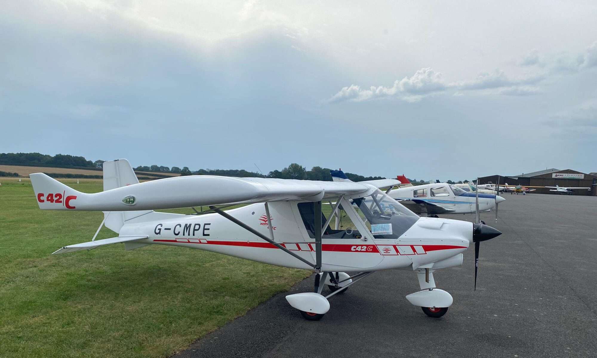
So the first task was to install the partly homemade iPad Mini 2 bracket. I’m using a homemade one as we have a Garmin satnav bracket in the aeroplane and I therefore needed to adapt a Garmin arm to take an iPad mini. This was made from a sheet of 3mm Perspex I had ordered and then cut to size and bent to shape using a heat gun, this was a lot easier then it may sound! An existing Garmin mount arm and ball and socket purchased online for around £5.00 the lot, some nuts, bolts and a circle of aluminium provided and assembled by a friend. The end result can be seen below.

The GPS mount was a universal phone suction mount that my son no longer uses, purchased online for around £3.00.

This post is not meant to be a review of Skydemon or the Garmin Glo, which I plan to do later, once I have got to know them better, however I will give my first impression of them both.

Skydemon

First Mike showed me how to remove the inadvertent waypoints I had added which was simply a case of dragging them to the next point, or the origin, or destination.

Which craft!

He next showed me pulling the compass up and out to reveal the HSI display, but the collapsed view is preferred.

Now with it all installed it was time to go flying, it was windy again so no flaps for take-off! We departed on runway 24 and flew the circuit leaving on the downwind leg to converge on the course shown on Skydemon, the first thing I noticed and liked is you could roll out on the heading as there is no over or undershoot, and the display shows you the direction you are travelling and the direction you need and when you are within a few degrees it turns green. It made it very easy to fly accurately, I just can’t see myself flying without it once I have my license the way it calculates the direction means you don’t need to allow for drift as it does this for you too!

We flew out to just south of King’s Lynn, then turned east over Bawsey Lakes and on to the village where I Live Gayton.

The Garmin Glo had a rock solid fix throughout so there is not much to say re this it just does what it says it does!

Flying back, Mike did his normal of, ok take me back, but this time I could use Skydemon and I flew us back without issue I used the extended centre line shown on the Skydemon map to line up on the runway very early. As I was about to touch down a gust of wind caused us to balloon, but I held it on the stick and made a very soft touch down, Mike complimented me on the land too!

This is what flying should be like, well for me anyway!!!

Kings Lynn
Bawsey
Gayton Norfolk
Gayton Hall
Gayton Cricket ground
Gayton, Norfolk

Back on the ground and with the aeroplane refuelled I was about to go home when Stuart asked if I would like to go for a fly with him, I did not turn him down! We stayed local as he flew a few circuits and then around the drains and back for some more circuits. It was very interesting to see how someone else flies, the main difference being he comes in much higher than I on the landings. I think I may have picked up a few tips from watching him fly.

Flooded drains
Welney Marshes

Navigation not so lost

Well after last week I can say for the first time I was not really looking forward to this week’s lesson, in my previous post you may have picked up on my dejected feeling following my return flight from Fenland.

This week I decided to try and take control, first I followed the advice left by Katie on last week’s post (thanks Katie) and used Google maps to become more familiar with the landmarks surrounding Chatteris, paying particular attention to those that should be on my return. Next I emailed Mike to find out where we would be flying too and was given either Fenland or Boston via the previously used routes.

So I pre planned the routes and on the day I added the wind and drew out the triangles of velocities at home for both, which was good practice too.

I went to the airfield still feel a bit downbeat, this was picked up on by Mike who said I should be enjoying it! I explained that after last week I was concerned about my ability to navigate especially to find Chatteris and to know the status of the parachutists. One option that Mike put forward and I think I will pursue is to go for my restricted License first then as I have a share in a C42 I can fly around and get my confidence at a much lower cost before adding the Navigation to it.

Mike asked what I would like to do today and said with some trepidation cross country dual to Fenland. I said this mainly as I wanted to confront my demons and prove to myself I can do it, or not!

So we discussed the approach at Fenland and how we were going to leave Chatteris too and we then set off. We taxied out to runway 24 and held there as Katie and Pat were on the runway at the far end putting down so grass seed. After a short while they spotted us waiting and cleared the runway and we took off, we flew the circuit while climbing and left on the base leg setting course to Whittlesey Station which is only 8nm, after setting course and completing the plog with the times I could see the brickwork smokestacks in the distance and knew from my Google research this was whittlesey I could see.

Small red is the train station and the larger red where the smokestacks are in Whittlesey

As we got nearer I noticed the light coloured industrial units which again from Google I knew where just below and to the right of the station. I flew over the station and set course to Fenland, I was a little slow getting on course, but I knew from studying the map I needed to fly over the east side of Thorney and over the bypass and indeed I was which was both good and reassuring, just after going over Thorney bypass it would be time to make the call to request an overhead join at Fenland which I did and they gave me the runway in use, the circuit direction and the Altimeter setting. A few minutes before the estimated arrival time I spotted Fenland and I changed course to fly over the numbers on Runway 26 at 2,000ft and called to say so. We were overhead and descended dead side.  We joined down wind, on final I came in a little low so I added a bit more power so as to touchdown beyond the displaced threshold and I made a good landing.

This had all gone much better than last week! Time for a cup of tea and then the return and to see if I would spot Chatteris or not!

Again we took off and followed the circuit leaving on cross wind and setting course to Whittlesey, with the smoke stacks clearly visible and the heading set we few towards it again I could see the industrial units so knew where the station would be, this was also helped by an approaching train!

When overhead Mike took the controls and we talked about London Centre and he made a “Practice Fix” call to which they responded that we had a 2 line fix putting us overhead of Whittlesey! A very useful service and they have a leaflet which explains more here.

I had the controls again and we were flying towards the Airfield I soon spotted Chatteris town and the Forty foot Drain above it which was our guide to the 16 foot drain where we joined the circuit for 24. However at this point Mike said fly the circuit for 24 but we are going to land on 23! This had me a little worried as I have never landed on 23 and it seems a lot narrower, the reason for landing on 23 was to ensure I didn’t go over the new grass seed! For the second time today I made a good landing and I was happy with my performance and so was Mike! The only things of note picked up were to correct things sooner, both in setting headings and when I realise I’m a little low on the approach.

So a good day flying which I enjoyed, however I think I will still go for my restricted license first.

One step forward two steps back!

Well if the weather had been better the plan was for me to do a solo navigation to Boston, however it wasn’t and I didn’t. Instead we did a dual navigation to Fenland Airfield via Whittlesey Train station thus creating a dog leg.

It had been 2 weeks since my last flight and it would seem my mind has been erased to the point that even though I blogged about how to draw the triangle of velocity I was stood staring at the  white board clueless! Still with some help from Mike on the first leg it slowly came back and I completed the flight sheet (here is a blank flight sheet (PLOG) I put to together based on the one we use in the club, feel free to modify/use it), I called Fenland as its PPR (prior permission required) and they told me the runway and conditions at the airfield. Mike asked how I would make a standard overhead join from the south direction and I drew this on the white board ok. Next Mike asked how I intend to leave Chatteris and the runway I would use again this was ok.

So into the C42 and let it warm up while we waited for the parachutists to descend. We departed on runway 01 and flew the circuit but kept climbing to our cruise altitude of 1,500ft and set course to Whittlesey, we arrived overhead bang on time, but a little to the right of track. I had some trouble spotting the train station as it’s only a small single platform one. After spotting it with the help of an approaching train we set course to Fenland. About 5 miles out from Fenland I made a call and requested an overhead join, this was the first time I have been to airfield with a control tower and getting the flow of messages in the correct format was all new to me but Mike guided me through what to say and when. We joined overhead descending on the dead side and landed on runway 36  the landing was not my best and Mike then informed me that when I do my solo cross country flights I have to hand in a form and have it signed, on this form one of the things they do is rate your landing!

At Fenland we had no time to stop for fear the weather was closing in, so I paid the landing fee and we set off back to Chatteris. It was the return navigation that fell apart! I took too long to set my course so we were away from where we should be and then I miss read the heading and somehow set the course of 350 and not 315, when asked where we were I struggled to correctly identify the position on the map, but after a while I found our location and corrected it buy flying over where we should be and resetting the course. At Whittlesey Mike ask if I was over the station and my reply was that “I thought we were“ thought was not good enough so we did an orbit and I was correct so we set course for Chatteris. I seem to keep drifting off course especially when reading the map and by the time we had got to Chatteris we were not approaching it from where we had planned. To make matters much worse I could not see the airfield Mike told me to turn to the left which I did and if he had not I would have over flown it, which as it’s a parachute club it is not allowed or safe to do. So we flow around the airfield in a wide circle and Mike enquired how I was now going to join and land. I was now disorientated and concerned over not having seen the airfield and was explaining how I would join 01, but talking about 19, eventually it click and we joined on the base leg and I landed. Mike commented that I would have got a 10 for that landing and it was one of my best. But during the debrief it was clear that I not ready for solo cross county with the lack of location awareness and the ability to fly a consistent heading in doubt too.

The day left me thinking on the way home, have got what it takes or if I should cut my losses and pack it in.

I love flying, but learning to fly, for me at least, is a rollercoaster of ability and emotions of which I’m current at a low point again!

I need to learn to read the map more frequently and relate it to where we are while keeping us on the correct heading and at the correct altitude; I hope over the next few weeks this will become easier and I become safer as the thought that I could have over flown the airfield while there was parachutists in the air concerns me greatly.

Navigation to Boston Airfield and Triangle of velocities

I arrived at Chatteris on what seemed a damp and grey day around an hour before my lesson to plan my flight to Boston as I was nearing the airfield I saw a C42 flying in the circuit and I was thinking to myself that the parachutists would not be jumping with such cloud cover, however as I turned into the track leading to the airfield I saw the twin Otter taking off closely followed by the main training C42. It often seems to have its own micro climate which allows for the microlight and the parachutists to go up while all-around the weather would not permit! When I left home it was layer cloud and raining but here it was scattered cloud and improving all the time.

In the clubhouse I made myself a cup of tea and set about planning out my route to Boston, possibly my last dual navigation to Boston, all was going well and I drew out the triangles of velocities on the whiteboard and then checked my results on Skydemon light http://www.skydemonlight.com/ which is a great piece of software and I hope to buy and evaluate it on either on an Android or iPad once I have my license (so Lookout for a future review of flying with this!) most of my calculation worked out ok and with little head or tail wind I didn’t notice my fundamental error! In fairness to me it has been a while since I did the Navigation exam!

Triangle of velocities

So how do you draw the triangle of velocities?

First Draw a vertical line to represent North with a diamond on the top to show it as a true north.

Next plot the course you want to fly, for this draw a straight line from A to B on a map and read off the heading using a protractor. For Chatteris to Boston we want a heading or Trk(T) of 349° so next we draw this line on.

Next go to the Met Office and get the spot wind for your altitude, Sunday this was 260/15 so we now need to draw this on.


The wind is drawn across the north line e.g. above I marked off 260° on the left of the north and drew through N and out far enough to be able to mark off the wind speed on the wind line. Add 3 arrows to show it’s the wind line. Take a ruler and mark the wind speed on the line from the north line, it doesn’t matter what scale you use mm, cm, your map ruler, whatever so long as all  the measurement use the same scale. I used mm on this drawing for the blog.

Next draw a line from 15mm along the wind line the length of the speed you will be flying and make the line intersect the Trk(T) line at that point . So below I have drawn from the 15mm mark a line that is 70mm (we fly at 70knts) where it joins the Trk(T) B – C below.

 So above we have:

A – B 260° line with point B marked at 15mm (from the Met office 260/15)

A – C our Track True from the map

B – C 15mm along the wind line (wind speed) 70mm long (our speed in knots) drawn to intersect our Track true at the 70mm point

If we now measure in mm A – C we get 67mm and this is by the magic of pythagoras theorem our Ground speed allowing for the wind 67 knots.

If we measure the angle of the line B – C   from north we get 336° our heading true.

And if we measure the angle D we get our drift angle 13°

Thank you Pythagoras!

So back to my flight planning well the fundamental error I made was I measured B – C as the ground speed even though I had drawn it 70 long for my airspeed!!!

The flight to Boston went ok, I got a bit off course, but spotting Fenland airfield I re aligned and was ok from there. I soon spotted Boston and just to the left was the airfield.

We landed OK (in fact for me it was quite a good landing!) and I got the teas in, while we were drinking our tea Mike was asked to do a check Flight which he agreed to do as no one was booked in after me. I stayed drinking tea and chatting to people. Sometime later we all watch Mike land and needless to say it was a perfect landing in every way.

Once Mike was done we set off back to Chatteris and the navigation all went to plan we joined on a long final for runway 24 and again the landing was not bad. I refuelled the plane and cleaned the prop and some of the birds muck off the wings, as while we were out Stuart had booked the aeroplane and it was not good to hand it over in the state it was in.

My next lesson in a couple of weeks’ time and weather allowing is going to be a solo to Boston and back!!!


Navigation and what does the map say!

Today was looking good for my first proper navigation lesson; Mike had asked that I get to the club an hour beforehand to give him time to go over planning the route, allowing for wind etc. I dutifully arrived at the airfield an hour and 10 mins early. The weather was hot with a layer of broken could at around 8,000ft and no wind, the met office’s Low Spot Wind chart (214) showed variable at 5 knots.
On arrival things were not going quite as well at the club, the previous student (who will remain nameless) was late which had a knock on effect, his return was further delayed by the parachutist. I sat with Mike and we went through the planning of the route which was going to be Chatteris to Boston in a straight line, with no wind to allow for there was not much panning needed! I studied the map to establish the MSA (Minimum Safe Altitude) allowing for obstacles within 5 miles of the track and the highest I could find was 470ft, to establish the MSA we round this up to the nearest 500 and add 500, thus our MSA for this flight was 1,000ft. Our chosen altitude of 3,300ft saw us passing over Fenland airfield whose airspace extends up to 2,006ft so we were well clear of this, thus it was a direct route. On the flight log I noted down the radio frequencies for any station I might need on route Boston, Fenland, London Information, London Centre, Chatteris and Coningsby. Next I found the heading from the line on the map and added the magnetic variation to give the heading magnetic,  I measured the distance and worked out the time it would take us to fly it once we set course.
The previous student was now back and it was time to fly the route (well actually it was around 1 hour 45 minutes later then we had planned to set off!) we took off on runway 01 and set course to 350 degrees, we passed Fendland bang on the time estimate and all was going well. As we approached Boston Mike talked me through the radio calls need for “SAFETYCOM” which is how Boston operate, but also pointed out as it’s a shared frequency we should not make these calls until we were at 2,000ft or below. We descended down and made our first call to say we were 5 miles to the south and inbound, the next call was to say we were overhead. We turned once we were over Boston airfield and came back over the other end of the runway and called we were descending on the dead side, from there on the calls were as normal.

We landed OK and parked up, Mike introduced me to many people whose name I forget (if you are reading this, sorry!) We had a quick cup of tea and it was time to set off back to Chatteris.

Going back proved a little more difficult for me! I think this was due to having the map in the opposite direction to travel, I tried turning the map around, but Mike said this was not good practice, also you can’t read the place names as easily upside down!
Flying back we should have been at Chatteris 26 mins after setting course, but I could not see it and it transpired while playing with the map I had been going off course and was to the east of March, I still could not see Chatteris, but by now I could see the drains and I turned and followed these back, a route I knew well!

My next issue was the landing; I powered back where I normally did and found myself very high over the airfield so we went around, thinking the issue was that I was too tight in I went a little wider on the next go and we did get down near to the runway, but still too high and much too far down the runway, on the next go I took the power off earlier (not really early enough) and we made it down, but the touch down was a lot longer down the runway then I would have liked. This was all due to there being no wind to slow us down, this is not a situation I’m accustomed to and had not allowed for it, I hope it’s a lesson learnt for the future!
Another issue I had, and would love you feedback on, is the choice of glasses, I have a good pair of varifocal glasses which are fine for normal reading. they are set-up more for computer work, however reading the small print on the map in flight and on the ground is very much a challenge. Having Googled it, it would seem bifocal are generally better for pilots, what do you think?

Finding my way in navigation!

Not a good start to the day as far as flying goes; I normally book my lessons for 14:00 and was about to leave home at around 12:50 when I got a call from Mike. I assumed he must need to move my lesson for some reason, however on answering the call Mike ask if everything was OK, to which I replied “yes everything is fine, I’m just leaving now, I will be with you before 14:00”, the reply was, “I have you booked in for 12:00”. Sh*t, I thought and quickly checked my calendar, no  I have it written down as 14:00, then I checked the on-line system and as normal Mike is right and I’m wrong. Luckily for me Mike and AAA Microlights are very accommodating and by moving a few people around a little he found time to squeeze me in. Thanks Mike and apologies to all impacted.

Today’s lesson the first following my solo was navigation, I pulled out my map which had a route plotted on it from some time ago and Mike thought it was a good route to fly, but we were going to fly it in the opposite direction. Mike had me add the headings and 5nm lines on each leg counting back from each waypoint. I then added a wind arrow to the map and for this flight as the wind was light we made an approximation for the headings and time to fly each leg.

I had checked the aeroplane beforehand so we were ready to go, after starting up the parachute aeroplane called “Clear Drop” with gives around 5 mins before the first parachutists will be on the ground. Our engine was not even up to temperature for the power check, so we taxied away from the club house and waited for the engine to warm up and the parachutists to all come down. A while later we got the radio call “All Canopies Down” so we made our way over to Runway 06, not one I have used much, in fact I think this was only the second time.  Up we went and made a climbing turn to the right on to crosswind leg and then another on to downwind, just as if we were going to do a circuit, but we continued to climb until we reached a chosen height of 3,000ft. I spotted our first point on the map, a roundabout not far from the airfield so from here we changed direction to a heading of 230° towards our waypoint of Kimbolton and noted the time. At around the halfway point Mike asked what could I see and I saw an airport to my left which was Wyton and, after a little prompting, another airport to my right which was Peterborough, ahead was a third airport Alconbury which we flew over; this was re assuring as it meant I was on track. Next was the A1M, A14, A1 junction to my right and in the distance was Grafham Water, about 2nm to the right would be our turning point, Kimbolton Airfield. It appears that spotting little airfields from 3,000ft needs a little practice! I finally spotted it and we turned on to the next leg with a heading of 120° and a new waypoint of Main Hall. As we flew this short leg I called out the things I could see and tried to relate them to the map. As we approached Main Hall, going by the time flown, Mike asked if I could see it and I could not, we must have been over it and Mike suggested we orbit while I look for it, but even with Mike telling me where it was I could not see it! A needle in a haystack comes to mind. Then all of a sudden I can make out the grass strip from the surrounding grass fields! Note to self; on any solo navigations pick something easier to see and check it out on Google earth first!

Main Hall

Form here we turned on to 030° to get back to Chatteris. All the time on each leg I had to make corrections to both height and direction and every time I looked for a land mark I changed one or the other!

My first big error would have been, if Mike was not next to me, a simple one of misreading the compass, I was little disorientated from orbiting, else it would have been a simple turn to the left (it’s the only excuse I have!), but I knew I needed to set a heading of 030° so as the compass clearly has 30 marked on it, no problem, Mike asks do I really want 30? I look at the map and saw it said 25 so I said, no 25, then Mike pointed out my school boy error 30 and 25 on the compass are 300° and 250° I wanted 3 on the compass 30°.

Now with the correct heading we flew back to Chatteris and on the way we done some more landmark spotting and again it took me a long time to find one, Sutton Meadows airfield, which Mike pointed out so easily. I guess or at least I hope the more you fly the easier it gets to spot these things, as I did spot Chatteris airfield OK. Here stated yet more issues for me and I guess one of the main points of the lesson which was correctly joining the circuit.

So we were now flying at 3,000ft on a heading of 060° and needed to descend and turn to join the circuit on Base leg which we did, however before this I got confused and found myself thinking if we took off on 06 we need to land in the opposite direction i.e. 24!  I know this is wrong, but in my confused state it made sense to me! Mike needless to say corrected me and we joined left base for 06. With little or no wind the approach was faster and I rounded out and then stopped the round out and bounced, I put power on and went around the next time I was more composed and made an OK landing and taxied back to the club house for a much needed cup of tea.

As I was last to use the aeroplane and now have a share in it I needed to wash it before putting it away.

Just before washing it Frank was coming back in his Flexwing which provided me with something to take pictures of for this post!

I really enjoy my first navigation exercise, but it has also served to remind me just how much more I need to learn and how much more practice is needed before it becomes second nature.